

Total distance 703.6 km
Daily average 29.3
Today’s accumulated uphill elevation 118 m
Today’s accumulated downhill elevation 99 m
I had an easy start to my new Camino this morning – turn right out of the albergue and follow the walkway around the point past the lighthouse and there were soon signs to direct me on my way.
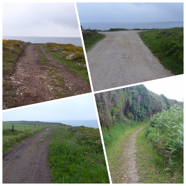
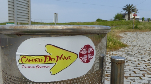
In fact there were a plethora of signs, mostly relating to the ‘Camino Natural de la Ruta del Cantabrico’, and initially pointing the way to AsCatedrais which was high on my list of wonders to see. These signs state the distance to the destination and there are also kilometre stones increasing with each stone, and in between small red-topped posts, initially scruffily painted, and later much more posh.
But there was also a yellow arrow with the initials V M (via del mar, perhaps?) and one or two Camino style yellow arrows, none of which I was expecting.

I had downloaded Camino forum member Alan Sykes’ wikiloc route and was following it on my iPad. So all in all there was plenty of signage.
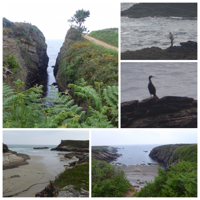
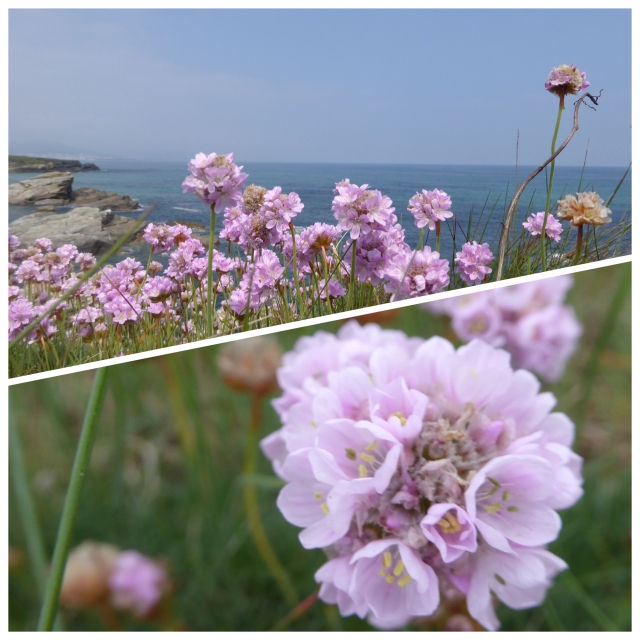
It was once again grey and misty, but not at all cold and no rain. I set off at a good pace, firstly on quiet roads and then onto sandy tracks leading directly to the cliff-tops. And that is where I stayed for pretty much the whole 17 km’s to As Catedrais beach. Even under a grey sky it was a wonderful walk. Just what I had naively been expecting all along el Norte. The trails followed the coast line religiously passing cove after sandy beach after craggy inlet, one immediately after another. There were plenty early morning Sunday fishermen up and about and the spring flowers were absolutely stunning. But the mist persisted and the sky and sea remained steely.

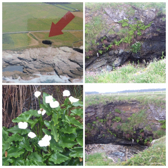
I passed a couple of interesting huge holes in the ground, presumably made by the sea coming underground. There were information boards, but I can’t remember what they were called, not the bufones (blow holes) that we passed much earlier on the Camino. These beautiful lilies were clinging onto the wall of the hole.
There was also a yellow arrow with the letters CS presumably for Camino de Santiago.
It was obvious when I was approaching As Catedrais because there was a lot of traffic around and a few coaches. A shame, as I would have loved to have the place to myself. But my timing just wasn’t great. The tide was on the way out but still too high for me to access all the huge rock structures (Wikipedia – As Catedrais beach translates as ‘Beach of the Cathedrals’. It is the turistic name of Praia de Augas Santas – ‘Beach of the Holy Waters’…… Its name is derived from the formations of its cliffs)

I stopped by the cafe above the beach for a cola cao and was charged an outrageous 2.5 euros for the pleasure, I made use of the facilities and went on my way. Soon after the sun struggled through the cloud and, although the sky remained dim, sea turned a beautiful blue. I guess if I had hung around for an hour the tide would have receded and the sun would have been shining and I could have taken some fab photos. But I didn’t arrive at my destination until 17:30 as it was, so it was probably just as well that I moved on when I did.
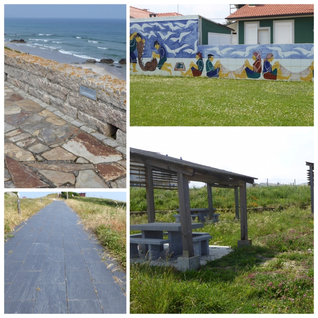
A short distance after As Catedrais Alan’s wikiloc route turned away from the coastline, but I was keen to keep following it, so I did a quick search and found a route that followed the Ruta do Cantabrico. I had already walked 17 km and following the coast would entail a further 21 km, rather than 14 km if I continued to follow my original wikiloc route. But I felt strong and I thought that I had been disappointed not to have seen more of the ocean on the Camino del Norte, and here was my chance and I should jolly well take it. It was a good decision for me and I thoroughly enjoyed the walk which from this point on was mainly on paved surface, but I found it very comfortable. There was some, but not too much, crazy paving, but with large pieces of stone that were not uncomfortable, and the rest was made of large slate tiles and was really easy to walk on. The track wound between cliff-top houses and followed every curve of the coast. I passed beautiful beach after beautiful beach. I took so many photos that even I got fed up with taking my camera out in the end.

I was very excited to see a new direction sticker about halfway through the walk and they were very much in evidence for a while and then ran out of steam. But there definitely seems to be a movement to promote this trail as the Camino de Santiago coastal route.
I stopped for a picnic of stale bread, very well travelled Brie (I have been carrying it for about 80 kms, but at least I like it runny), some fruit and tomatoes. Even the stale bread tasted ok in such wonderful surroundings. The trail is very well provided with benches and picnic areas and the paving must have cost a fortune. It really is a huge project to follow the coastline so truly.
I appreciate that I walked a very long stage today and that not many people would want to do this. But there was the option of catching the train (Feve) from just after As Catedrais either back to Ribadeo or on to Foz (I presume there is a station here). Then you could return to where you left off the next day.
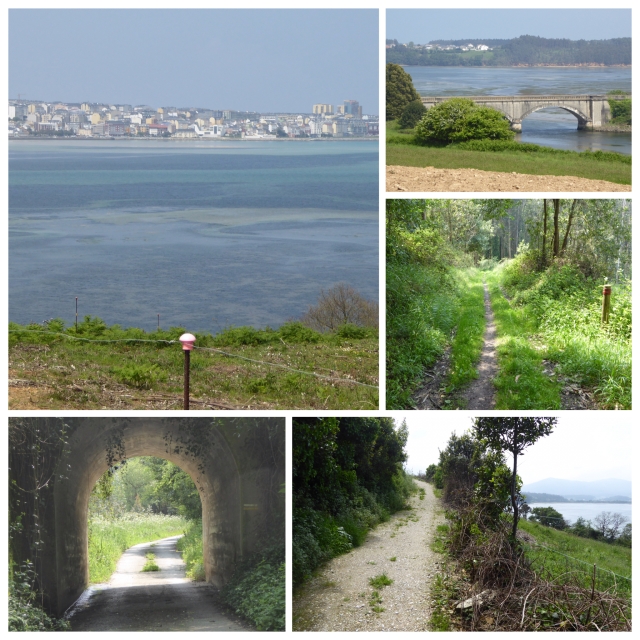
After I had walked probably around 28 kms the buildings of Foz came clearly into view, across an estuary. They weren’t far away – that is if I could have somehow travelled directly across the water. But that wasn’t going to happen. The bridge to cross the river was 5 or 6 km’s away, and I have to say that some of this walk seemed to go on for ever, although plenty of it was through pretty woodland. I was glad I was following a wikiloc trail because there were a couple of points in the last stages where the signage wasn’t immediately clear and I could refer to the gps and save myself making mistakes. I am very pleased to have my new (second-hand) iPad with sim for lots of reasons, but for this one in particular.
This new adventure is going to cost me considerably more in accommodation than normal on Camino, because there are no albergues to stay in and the stopping points are holiday resorts so are more expensive anyway. I had found a hostal for 18 euros, but when I phoned yesterday to book, I was told that it was closed. So I have ended up having to pay 48 euros for the night. And I don’t like it one little bit. I am staying the the Hotel O Norte which is rather (very) old fashioned but it had piping hot water for my second bath in a week and I haven’t actually moved from the room since arriving.
Hopefully the wifi will be good enough to load the photos into this post and I can get if off before going to sleep. It will be good to catch up on my blogging. Lack of company has its compensations!


You are truly an amazing woman Maggie and good for you trekking off on the road less travelled. You had a very long day and it sounds like it was well worth the effort. Their was no mention of your feet so I’m assuming they are still holding up nicely. What an adventure you’re having! Keep it up, there are many of us living vicariously thru you right now. Thanks for the effort I know a good blog takes, and continued safe happy travels to you!
LikeLike
Many thanks Sandy. The feet are doing well – just an odd ache at the end of a long day. Have had to reapply the nail varnish though – there are standards to maintain!
LikeLike
What an inspiration you are Maggie. Lovely photos and great writing – very well done! xx
LikeLike
Thanks Marianne – all going well so far x
LikeLike
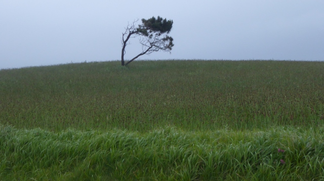
I absolutely adore that first photo of the almost Bonsai tree in its setting, beautiful curvature and grass framing. A wonderful artistic eye at work there Maggie, keep it coming! And stay well in body and spirit,
B
LikeLike
Thanks Brien – it was just begging to be snapped!
LikeLike
A long hard day Maggie and eye wateringly expensive. Worth it though for all the beautiful photos and the gorgeous sights. Thanks for posting the wonderful photos. Stay strong and fit, you continue to be an inspiration to me. Buen Camino xx
LikeLike
You made it to the Playa de las Catedrals! So jealous 😀 Buen camino!
LikeLike
I am due to co it use the Norte from Aviles soon… And am VERY inspired to change course, even though I have done the Ingles. Thank you for a much enjoyed voyage.
LikeLike
Thank you Phillip. So far it has been a very enjoyable experience. I hope I can provide some useful information.
LikeLike
You don’t walking for days alone in a strange world with no-one to walk to? You’re so brave and grounded. Love the pictures. ❤ ❤
About your feet, who Canadian woman walked the Camino, swears she had little trouble with her feet and felt the secret was she slathered tons of Vaseline on them every morning.
LikeLike
The walking is fine but I do like s bit of company in the evening. I’m can manage for a few days until I reach the next populat d Camino.
LikeLike
Let’s put an angel on your shoulder for company till then. ❤
LikeLike
Hey Mag,
we have been so sad that we didn’t have the possibility to say Goodbye to you.
We wish you a joyful trip with a lot of wonder-ful experiences and nice People around you. Don’t get lost😉Rejoice greatly✨💫💃
Christina and Hanna😘
LikeLike
So lovely to hear from you. Have been thinking about you. Stay positive and keep in touch x
LikeLike
Mag, can you please post a link to Alan Sykes wikiloc maps,
Thank you
LikeLike
You will find them in his forum thread John, plus lots of other useful info.
LikeLike
I am rereading your blog…. It would be good to have some understanding of the ‘wikiloc’ and also of the GPS system that you are using. Do you have a map as well, or print outs? Any clear technical input would be much appreciated to aim to retrace your steps. Thanks you in advance!
LikeLike
Hello Philip. Wikiloc can be downloaded onto a smartphone or tablet. It is very easy to use. It is my GPS system. I am absolutely no good with large scale maps – I find a background satellite image much easier to understand. Download wikiloc and play with it. It you have any questions, I will try to help. Someone else has just suggested another app called Viewranger which I will take a look at when I have time.
LikeLike
Dear Maggie,
I live in Tapia de Casariego and I want to wandern el Camino del Mar but there is not much more new.Last Saturday in the Tourisme Office in Ribadeo didn’t know to tell me whether the hostals and hotels have special prices for pilgrims. Did you get lost many times in this Camino ? I have been to Burela,Foz, Morás, Celeiro,San Andrés de Teixido but I visited these places by car.Do you recommend me to forget the idea of this Camino ? How much money have you spent more or less in hotels ? I would like to walk it .I will write to Amigos del Camino and ask them if this Camino is now better. Best regards.Muchas gracias and always Buen Camino
LikeLike
Hi Concha, I loved this camino but I walked a mix of the Camino do Mar and the Camino Natural de la Ruta del Cantábrico. The ‘official’ Ruta do Mar does not stay on the coast. You can see info here. The Camino Natural absolutely hugs the coast but finishes at O Vicedo. It is very well marked and a beautiful route. From O Vicedo to Ferrol I used a combination of wikiloc routes, which were very useful, but a bit tricky in places. The only stage I didn’t like was from Cedeira to Ferrol which I walked entirely on road. The accommodation was much more expensive than on the main caminos. I paid between 25-30 euros most nights. I didn’t really get lost but I used my iPad (with sim card) a lot of the time with satellite maps, so I could see exactly where I was. It is a very lonely route, but I quite liked that for a week. I would walk it again without hesitation – it was the most beautiful route.
Buen camino!
LikeLike